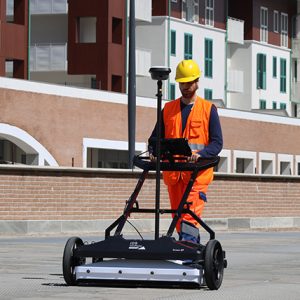
Stream X

Ground penetrating radar for extensive underground 3D mapping
Introducing a new GPR for extensive 3D mapping of buried structures and geologic features. Stream X is the IDS vehicle-towed ground penetrating radar solution, The Stream X array covers a 2 m wide swath with a single pass.
To achieve complete coverage of the survey area, multiple passes can be controlled through sophisticated positioning systems and a dedicated navigation software. Once the desired area is covered, the survey can be easily checked and then post processed with a dedicated IDS software platform.
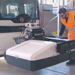
Stream X is part of the Stream family which provides high-technology products for an advanced investigation of underground utilities. Meet the other products of this family: Stream DP; Stream T; Stream UP.
Stream X is the ideal solution for mapping of:
- Extensive archaeological sites
- Detection of underground structures
- Cavity identification and mapping
- Underground tank detection
- Area clearance prior to construction
All the Stream X configuration are FCC certified and able to operate in the United States.
The systems features:
- Massive array of antennas: Stream X can be equipped with three different array configurations from 16 to 48 channels. A three times the closest spacing on the market, antenna spacing in the Stream X can be as little as 4 cm.
- Different frequencies (200 MHz or 600MHz): Stream X can be equipped with a 16 channel 200 MHz array in order to achieve the best penetration. Maximise resolution with a 24 – 48 channel 600 MHz array.
- Mechanical frame: A solid mechanical frame which has been tested in several rough terrain conditions and harsh environments.
- 3D tomography: The most defined underground 3D model currently available.
Benefits of the Stream X include:
- Cost reductions in underground investigation procedures while also providing more information on what is buried underground;
- Increased performance: Able to detect the presence and shape of anomalies present in the soil;
- Fast and accurate survey even in rough terrain;
- High productivity: up to 1 hectare/hour and a dedicated post processing platform;
- Highest data resolution with an antenna spacing as low as 4 cm